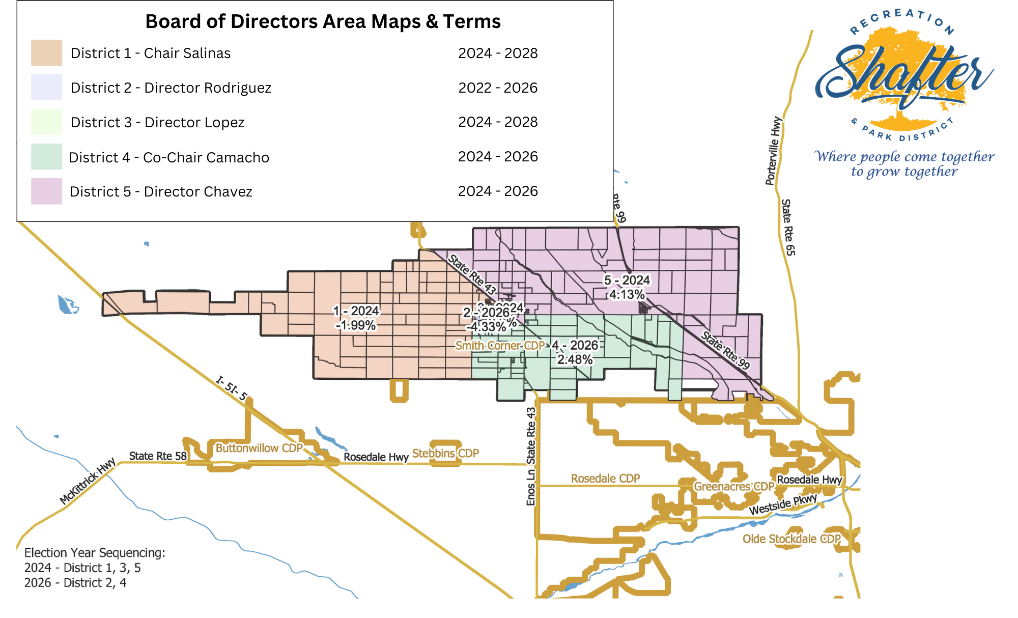
Districting Maps

The Board of Directors has voted to change the way by which they are elected from at-large to by-district (or division).  In an at-large election system, all voters that live within the territory of the SRPD can vote for all members of the board, and board members may reside anywhere within the district.  In a by-district election system, the territory of the SRPD is delineated into separate electoral districts or divisions, each with one Board member who resides in the division and is chosen by the voters as residing in that division.


A district map for Shafter Recreation and Park with election years and percentages for each district.
Map showing the Shafter Recreation and Park District's final zoning, divided by district numbers, with election sequencing dates.
A district map showing different areas with election year sequencing for a park and recreation district.
A detailed demographic map with population data by census block and election sequencing information.
A color-coded district map for Shafter Recreation and Park with population data and election sequencing.
A color-coded district map with population data by census block and election year sequencing for a recreation and park district.
A map displaying districts and election sequencing for Shafter Recreation and Park District.
A map showing election district details with voter percentage changes and election year sequencing for a recreation and park district.
A map showing the detailed boundaries of District 4 East within the Shafter Recreation and Park District.
A color-coded district map with election sequencing info and percentages for a recreation and park district.
A district map with voting regions colored differently, labeled with election years and percentage figures.
A detailed map showing Shafter Recreation and Park District boundaries with district numbers and election sequencing.
A map detailing districts in the Shafter Recreation and Park District, showing district boundaries and election sequencing.
A map showing population details by census block with election sequencing in a park district.